Ruth Will
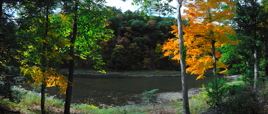
We’ve been here for a week. We’ve walked, biked and drove around. A coupe of days ago we found an easy trail to hike – the Ruth Will trail over off route 44. It’s about a three mile long hike. With a beautiful day of temperatures hovering in the low 60s, we headed off from the trailhead on route 44.

The leaves were almost peak I’d say. Just a beautiful day.

Sassafras leaves 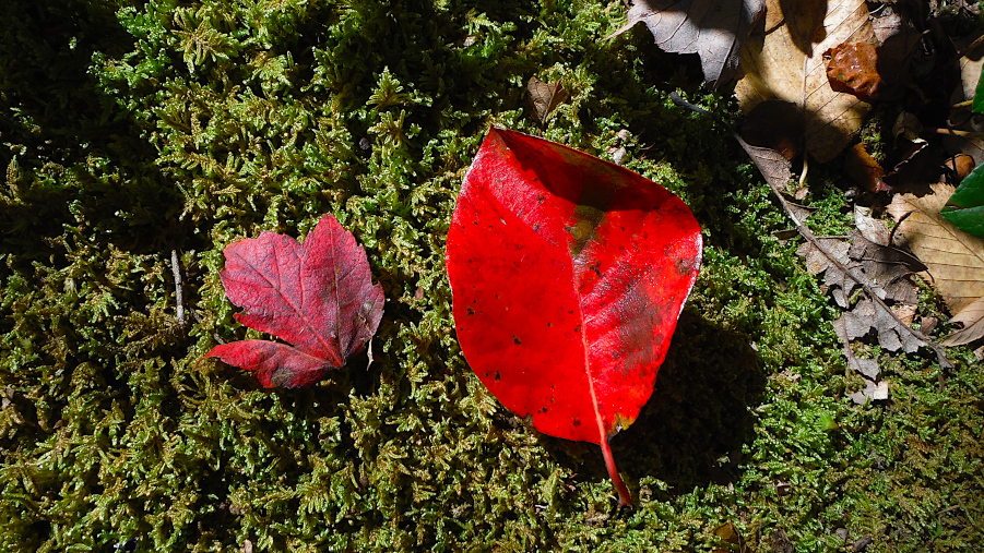
Maple and ? – maybe a birch?
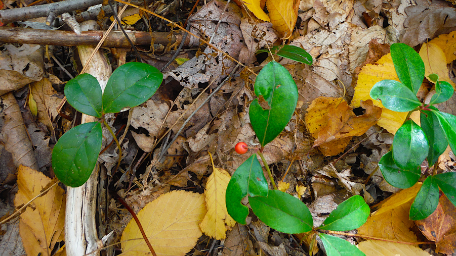
We saw some Winergreen along the way. Smells like Wint-o-Green Lifesavers when you pinch the leaves.

Sign for the Baldwin Branch split off was positioned before we got to the bottom. The direction we headed (clockwise) went downhill from the start. We’d climb back uphill on the return.
I think part of this hike has you on the Black Forest trail for a little way.

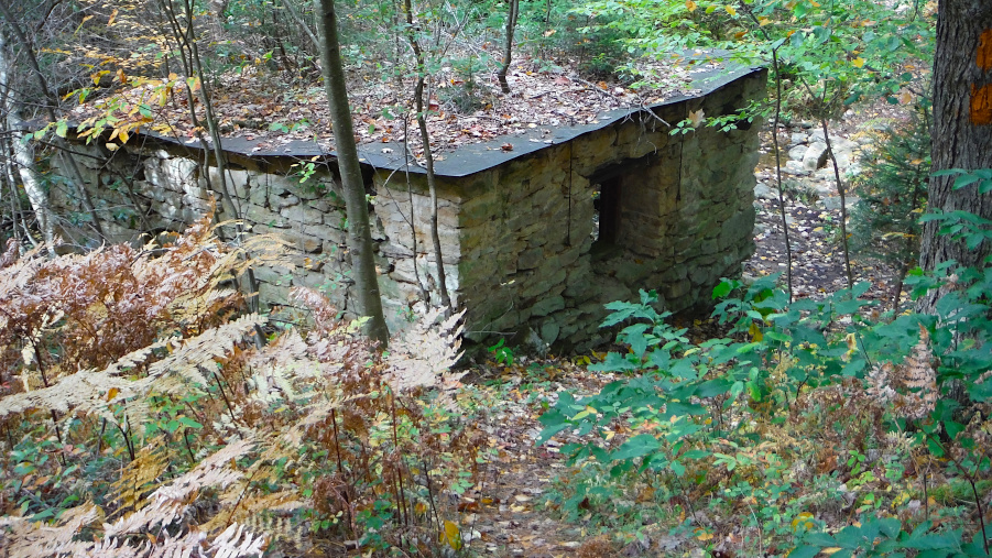
At the bottom of the trail, we saw this stone structure. If those walls could talk, I wonder what they’d say?

When we got back to essentially the top, we saw these stone cabins and a fire tower.
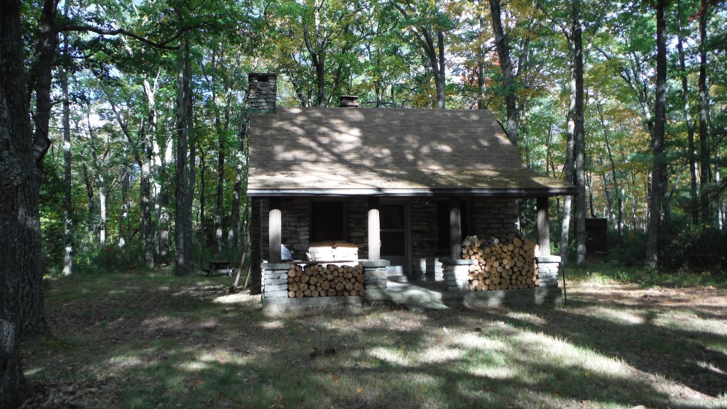
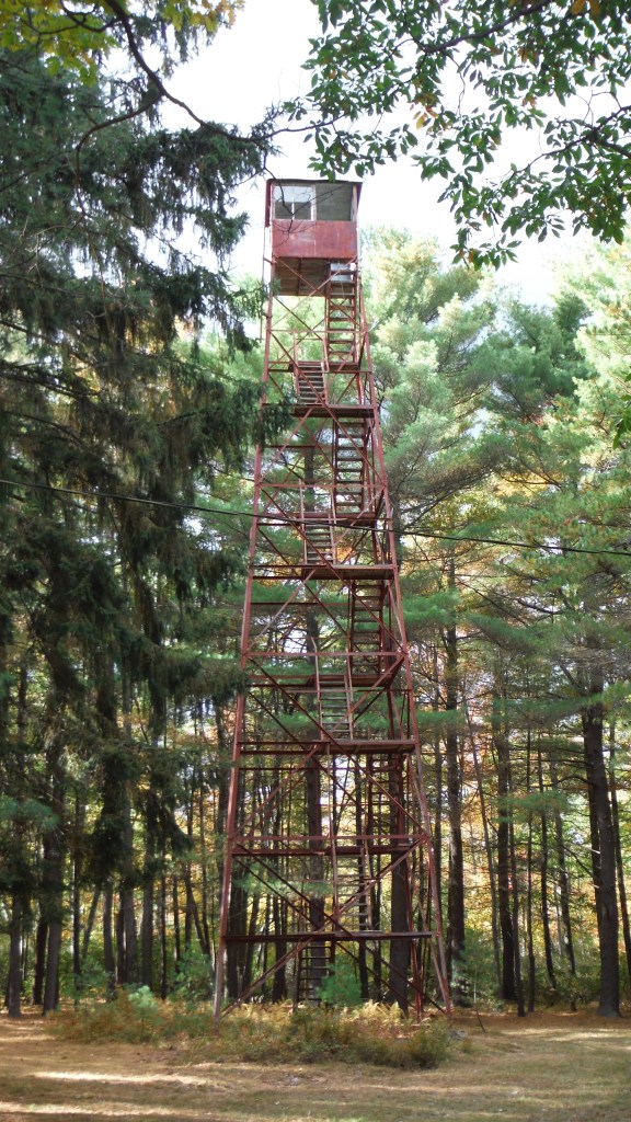
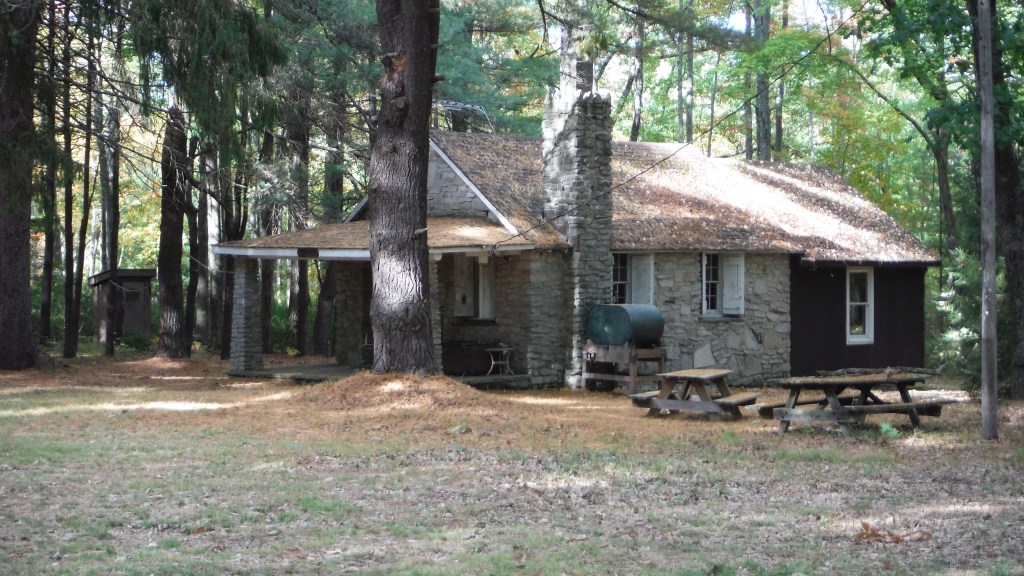
I always feel a little funny when I hike and come into close proximity to a cabin. The trail is pretty clearly marked and it goes right by one of these cabins and the tower. Its a pretty flat hike back to the parking lot when you get up on top with these cabins. But the trail does still go south (I think) from the tower – it parallels route 44.
It was a great little hike.

Fall Fishing
The wife and I took a short walk in Slate Run along the Rail to Trails today. When we got back I scanned Pine for a little while and noticed some fish rising. I thought maybe Fall fish of even a bass might have been working. The more I watched though, I thought I’d give them a go and try to catch something.

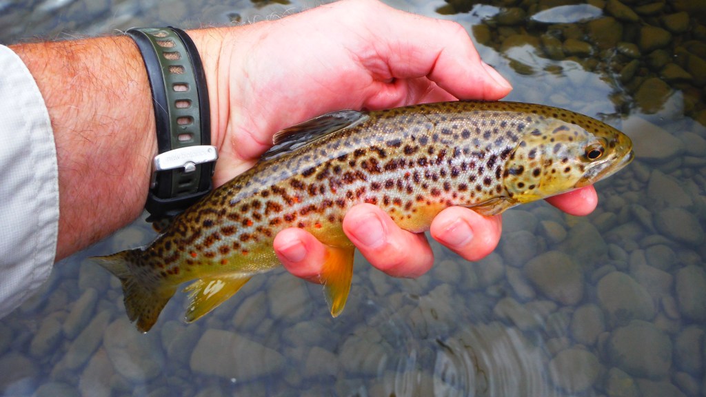
This and the next one were caught using an ant. The takes weren’t hard hitting but I reacted effectively enough apparently.


Back home safely!
There were more fish rising and a light shower or two happened but that didn’t dampen my spirits. The fish were definitely Brown Trout Club fish and they wanted nothing to do with the ant, or Slate Drake, or caddis, or little yellow emerger, or… you get the idea.


The little black spec came out some 100 yards below me. I don’t know if it saw me but it decided to go up the mountain instead of up along the creek toward me. About an hour and a half later it returned to the same spot.

The take wasn’t a hard hitting one – similar to the others. You might have to google this one – I caught it on a Screaming Banshee! It’s a sort of/kind of down, split wing caddis with a piece sticking out the front even! A weird looking thing that I’ve had occasional success with.

These deer crossed about two hours after the bear had shown. Thing is, I saw the bear again a little later. It was close to time for me to quit for the evening anyway.
Think I’ll try to tie something up special for tomorrow. Hopefully that’ll work a little more consistently.
Reporting from Slate Run … Till we see each other again… UB


Loved the photos, Marion. What kind of camera do you use?
LikeLike
Hi Steve, thanks for commenting! I use a Fujifilm FinePix XP70. It’s a little compact, automatic camera that replaced a prior generation camera I had that I dropped into Pine Creek a couple of years ago. That one was not waterproof – this one is (The XP70 is). I’ve taken to post processing most of the images I post in the blog – I use GIMP. I basically boost the saturation a little (about 15% – 30% usually), use a ‘filter’ function to enhance the sharpness, and scale the image down so it works on the website well. Thanks again for commenting Steve. – UB
LikeLike
Ruth Will hike & so will Marion! Nice job capturing autumn beauty while presenting some outdoor opportunities in the area…
LikeLike
Thanks much Rivertop Rambles! Should be peak up your want shouldn’t it be? Or has it already peaked and now leaf-off? We head back home tomorrow but I’m coming back in a week and a half! It’ll be the last trip of the season before the ‘close up’ stay in November. This season went by too quickly! Take care RTR! UB
LikeLike
The fire tower was it on the east side or west side of route 44 ? Not familiar with that trail
LikeLike
Hi Dale, The tower was on the west side of 44. When you get to 44 from Slate Run road, I traveled south about 3 miles. The parking lot is on the left, the trailhead on the right. If you hike counter-clock-wise you would hike up just slightly and when you get into the wooded area, the tower and cabins are apparent – not far from the trailhead when hiking counter-clock-wise. UB
LikeLike