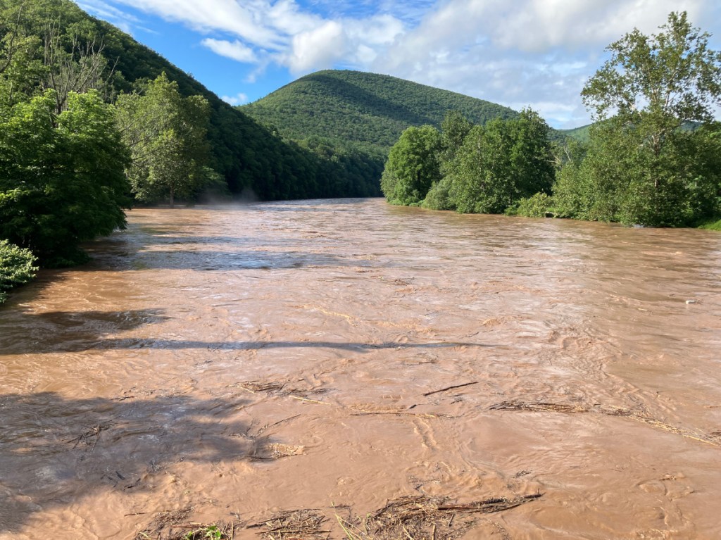
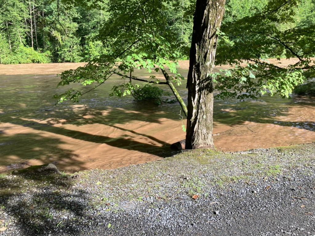
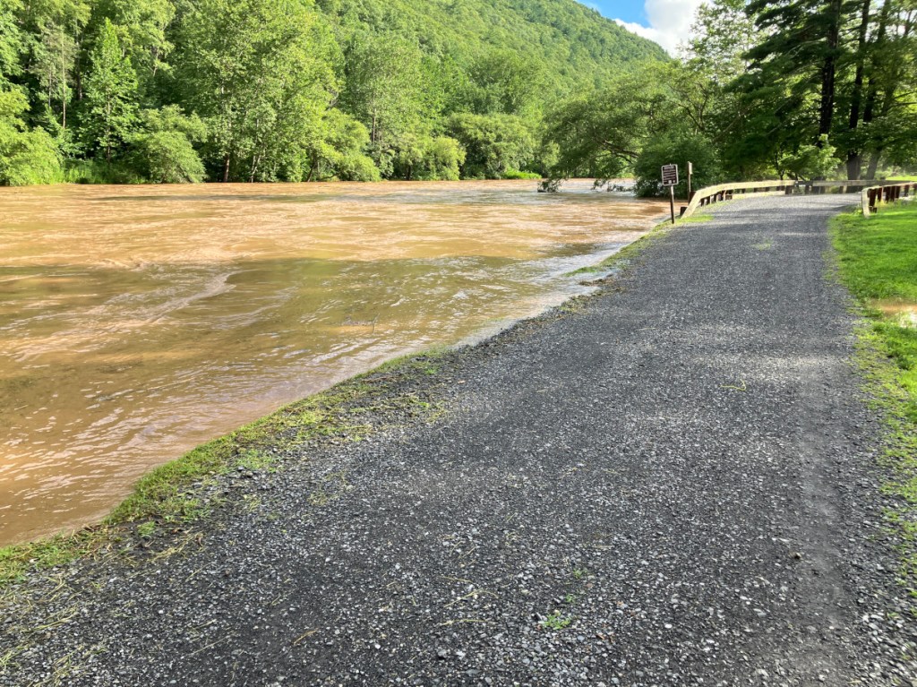
I’ve been here in Slate Run for a few weeks and now I am expecting my wife and her sister to arrive later today, Friday, August 16th. I have been here for the ‘Great Flood’ event that took place here in the area about a week ago. Please forgive me for not getting to writing about this event as it unfolded. It was quite something to witness. The crest at Cedar Run was just over 11 feet. I’ve been told that Agnes, the hurricane that dwelled off the Atlantic coast back in June of 1972 crested at 16 feet. Maybe some of you will remember how it only seemed to rain for 40 days and 40 nights. I was a young lad, but I still remember having to stay inside much of that Junethe time back then.
My fishing buddy was going to come up for a visit and take a drive back into the mountains to see the high water. He arrived by coming through Jersey Mills which was surprising as that section of 414 along Pine will flood and close that route. That would have forced him to go up Route 44 and get off on Slate Run Road – but he didn’t have to so – no worries. I think 414 was closed there where Pine comes up closest to the roadway during the peak flood stage. My fishing buddy and I decided to go up and see what Morris Run was looking like just after the rain had stopped.
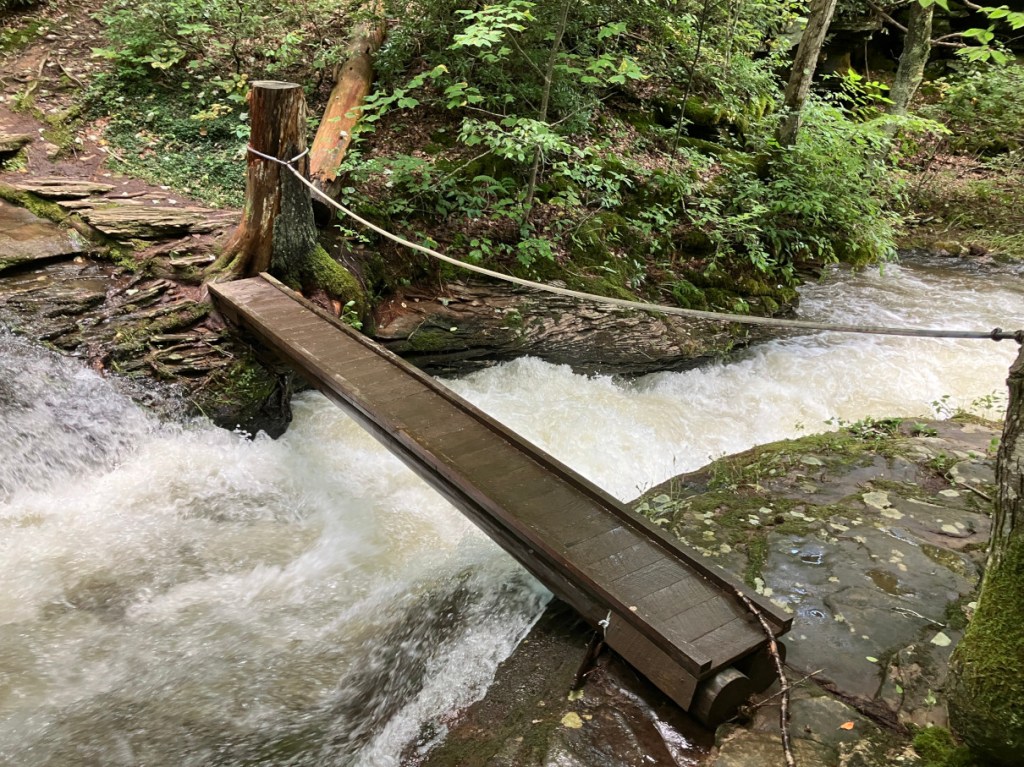

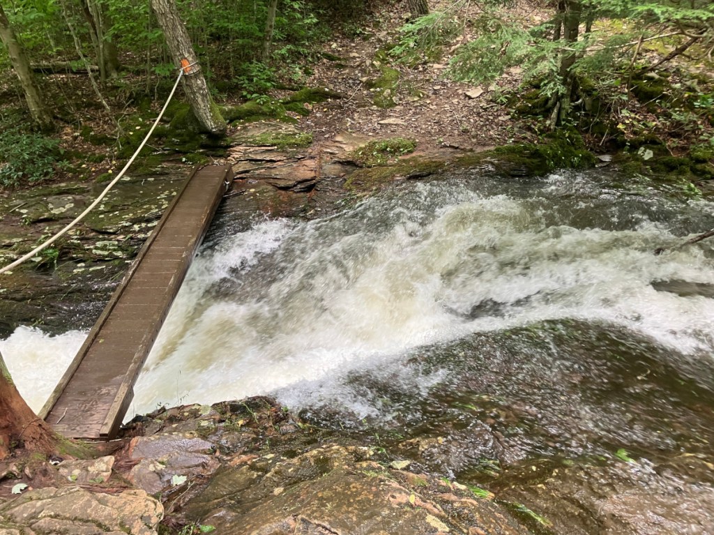
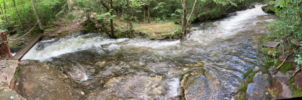
Yes, once we saw it wasn’t over the footbridge we decided to walk across it (to reach the other side of course). I thought I was supposed to become wiser the older I got? Nothing happened that caused alarm – well -except actually walking across the wet-tish bridge and possibly falling to your most certain death. They’d of probably found me in the West Branch of the Susquehanna by the time they’d of caught up with me. But, not to worry – all was well. Did I mention there was a lot of water?
Hey, the saying goes “water flows down-hill” right?


So this leads us to…Navel Run and Navel Run Road!
Little Slate… right, that’s what you’re thinking of next right (it’s just down stream so logically)?


This rain/flood event was ALL the new bridge over Little Slate could handle – in my opinion. I’m guessing it was designed to handle even more water and debris possibly backing up on the bridge – I’m sure, right?
There’s been this branch off the big old pine tree outside our place that looks like it must of came off the original tree maybe 30… 40 years ago possibly? Well, I decided to cut a seat into this log just laying there right? It’s been a great place to sit and either contemplate the world’s problems or scout to fish out in back here. Well (sighs), it comes with heavy heart but…


IT’S GONE!
I didn’t think that thing would move until another Agnes hit! To be redundant – Agness … June of ’72 right? Pine Creek at Cedar Run just over 16 feet… right? This flood was just over 11 feet. I think I have five more feet of capacity here to not have to concern myself but… what you have to think about is what is all upstream of you that could be impacted by such high water. And as I’m sure most of you know, it’s not just high water that is the impact that a flood threatens with, its all the debris it picks up along the way and flows downstream that gets you. And while the actual water may be of great concern, its the debris that the water pushes, usually ahead of the water pushing it, that needs to be of even greater concern. Ask the people over in Austin and Costello, Potter County. They’ll still remember it’s flood from a hundred years ago.
So just because you might think you’re safe as far as water level goes, if a flood creates it’s own little ‘mini-dam’ and that backs up for a while, it lets loose and then, as I eluded to before, it all goes downstream!
And on such an uplifting point I’ll say, till we see each other again, I’m UB, and unintentional blogger.
